
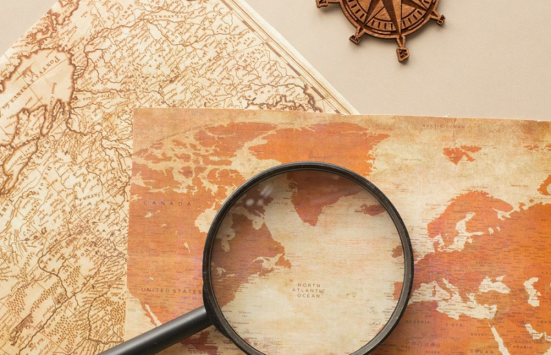
Geography questions test our knowledge of the world around us—from countries and capitals to rivers and mountains, from population facts to climate zones—and these 60 carefully selected questions with detailed answers cover the essential topics every geography enthusiast should know. Whether you’re studying for a quiz, preparing for a geography bee, hosting a trivia night, looking to expand your general knowledge, or simply curious about our fascinating planet, this comprehensive collection provides questions ranging from beginner-friendly to genuinely challenging, organized by category to help you learn systematically.
Geography isn’t just memorizing facts and locations on a map. It’s understanding how our physical world shapes human civilization, how natural features influence climate and culture, how borders and territories reflect history and politics, and how interconnected our global community truly is. Every mountain range affects weather patterns. Every river system sustains civilizations. Every capital city tells a story of national identity and historical development. When you learn geography, you’re really learning how Earth works as a system and how humanity has adapted to, modified, and organized itself across this remarkable planet.
Perhaps you loved geography in school and want to test how much you remember. Maybe you’re preparing for an exam, competition, or job that requires geographical knowledge. You might be planning travels and want to learn more about potential destinations. Or possibly you’re just someone who finds it genuinely fascinating to know that the Nile is the longest river, that Vatican City is the smallest country, or that the Pacific Ocean covers more surface area than all land on Earth combined. There’s something deeply satisfying about understanding the basic facts about our world—it makes news stories more meaningful, travel more enriching, and conversations more interesting.
The questions in this article span multiple categories to provide comprehensive coverage of geography as a discipline. You’ll find questions about physical geography—the natural features of Earth including mountains, rivers, deserts, and oceans. You’ll encounter questions about political geography—countries, capitals, borders, and territories. There are questions about human geography—populations, cities, languages, and cultures. And you’ll discover questions about unique geographical facts—record-holders, unusual features, and fascinating oddities that make Earth such an interesting place to explore.
This collection is designed to be practical and user-friendly. Questions are organized by category rather than randomly mixed, making it easier to focus on specific areas you want to study or to create themed quiz rounds if you’re hosting an event. Each question is immediately followed by its answer, so you don’t have to flip between sections. Difficulty varies throughout—some questions are straightforward (What is the capital of France?), while others will challenge even geography buffs (Which country has the most time zones?). This variety means the collection works for multiple purposes, from family game nights to serious study sessions.
Geography knowledge connects us to our world in meaningful ways. It helps us understand current events with deeper context—why certain regions experience conflict, how climate change affects different areas, why some nations are wealthy while others struggle. It makes us better travelers who can navigate with confidence and cultural awareness. It provides conversation topics that transcend differences—everyone lives somewhere, and discussing places and cultures builds bridges between people. Perhaps most importantly, learning about Earth’s incredible diversity—both natural and cultural—helps us appreciate this remarkable planet we all share and reminds us of our responsibility to protect it.
So whether you’re testing yourself, competing with friends, studying for academics, or simply exploring out of curiosity, these 60 geography questions offer a comprehensive tour of essential geographical knowledge. Challenge yourself to see how many you know before checking the answers, or use this as a study guide to systematically build your understanding. Either way, you’re about to embark on a journey around the world without leaving your seat. Let’s explore!
Physical Geography: Landforms, Water Bodies, and Natural Features
Physical geography examines the natural features of our planet—the mountains, rivers, oceans, deserts, and other formations created by geological processes over millions of years. These features shape climate, influence human settlement patterns, and create the stunning diversity of landscapes that make Earth so beautiful.
1. What is the highest mountain in the world?
Answer: Mount Everest, located in the Himalayas on the border between Nepal and Tibet (China), stands at 8,849 meters (29,032 feet) above sea level.
2. Which is the longest river in the world?
Answer: The Nile River in Africa is generally considered the longest at approximately 6,650 kilometers (4,130 miles), flowing through eleven countries including Egypt, Sudan, and Uganda. (Note: The Amazon River is sometimes cited as longer depending on measurement methodology.)
3. What is the largest ocean on Earth?
Answer: The Pacific Ocean, covering approximately 165 million square kilometers (63.8 million square miles)—more than all of Earth’s land area combined.
4. Which desert is the largest hot desert in the world?
Answer: The Sahara Desert in North Africa, spanning approximately 9 million square kilometers (3.5 million square miles) across multiple countries including Algeria, Egypt, Libya, and Morocco.
5. What is the deepest point in the world’s oceans?
Answer: The Challenger Deep in the Mariana Trench, located in the western Pacific Ocean, reaching approximately 10,994 meters (36,070 feet) below sea level.
6. Which waterfall has the greatest height in the world?
Answer: Angel Falls in Venezuela, with a height of 979 meters (3,212 feet), making it the world’s tallest uninterrupted waterfall.
7. What is the largest island in the world?
Answer: Greenland, covering approximately 2.16 million square kilometers (836,000 square miles). (Note: Australia is larger but is classified as a continent rather than an island.)
8. Which mountain range is the longest in the world?
Answer: The Andes Mountains in South America, stretching approximately 7,000 kilometers (4,350 miles) along the western coast through seven countries including Chile, Argentina, and Peru.
9. What is the largest lake by surface area?
Answer: The Caspian Sea, despite its name, is actually the world’s largest lake, covering approximately 371,000 square kilometers (143,000 square miles) and bordered by five countries including Russia and Iran.
10. Which volcano is the tallest on Earth when measured from base to summit?
Answer: Mauna Kea in Hawaii, which rises 10,210 meters (33,500 feet) from its base on the ocean floor, though only about 4,207 meters (13,803 feet) is above sea level.
Countries, Capitals, and Political Geography
Political geography examines how humanity has organized itself across Earth’s surface—the countries we’ve created, the capitals we’ve established, the borders we’ve drawn, and the territories we govern. Understanding political geography helps make sense of international relations, global news, and cultural differences.
11. What is the capital of Australia?
Answer: Canberra (not Sydney or Melbourne, which are larger but not the capital).
12. Which country has the largest land area?
Answer: Russia, covering approximately 17.1 million square kilometers (6.6 million square miles), spanning eleven time zones from Eastern Europe to the Pacific Ocean.
13. What is the smallest country in the world by both area and population?
Answer: Vatican City, covering only 0.44 square kilometers (0.17 square miles) with a population of around 800 people.
14. Which country has the most official languages?
Answer: Zimbabwe, with 16 official languages including English, Shona, Ndebele, and 13 other indigenous languages.
15. What is the capital of Canada?
Answer: Ottawa (not Toronto or Montreal, despite their larger populations).
16. Which country is located on two continents?
Answer: Turkey (and also Russia and Egypt), with territory in both Europe and Asia, divided by the Bosphorus Strait.
17. What is the newest country in the world?
Answer: South Sudan, which gained independence from Sudan on July 9, 2011, making it the world’s newest sovereign nation.
18. Which country has the most neighboring countries?
Answer: China and Russia are tied, each bordering 14 other countries.
19. What is the only country that is also a continent?
Answer: Australia, which is both a country and a continent.
20. Which country has coastlines on both the Atlantic and Pacific Oceans?
Answer: Several countries meet this criteria, including the United States, Canada, Mexico, Colombia, and Chile. (Any of these is correct.)
Population, Cities, and Human Geography

Human geography explores how people distribute themselves across Earth, create urban centers, form cultures, and interact with their environments. Population questions reveal fascinating patterns about where and how humanity thrives.
21. What is the most populous country in the world?
Answer: India surpassed China in 2023 and now has the world’s largest population at approximately 1.43 billion people.
22. Which city is the most populous in the world?
Answer: Tokyo, Japan, with a metropolitan area population exceeding 37 million people, making it the world’s largest urban agglomeration.
23. What is the least densely populated country?
Answer: Mongolia, with approximately 2 people per square kilometer, featuring vast open steppes and deserts with sparse population.
24. Which continent has the most countries?
Answer: Africa, with 54 recognized sovereign nations, more than any other continent.
25. What is the most visited country in the world for tourism?
Answer: France, which consistently receives more international tourist arrivals than any other country, typically exceeding 80 million visitors annually.
26. Which city serves as the headquarters for the United Nations?
Answer: New York City, United States, though the UN also has major offices in Geneva, Vienna, and Nairobi.
27. What is the most linguistically diverse country?
Answer: Papua New Guinea, with over 840 living languages spoken among its population of about 9 million people.
28. Which country has the highest life expectancy?
Answer: Monaco and Japan typically rank highest, with average life expectancies exceeding 84 years.
29. What is the largest city in the Southern Hemisphere?
Answer: São Paulo, Brazil, with a metropolitan population of approximately 22 million people.
30. Which European capital is furthest north?
Answer: Reykjavik, Iceland, located at approximately 64°N latitude, making it the world’s northernmost capital city.
Continents, Regions, and Geographic Zones

Understanding Earth’s major continental divisions and regional classifications helps organize geographical knowledge and reveals patterns in climate, culture, and development across large areas of the planet.
31. How many continents are there?
Answer: This depends on the model used. Most English-speaking countries teach seven continents: Africa, Antarctica, Asia, Europe, North America, Oceania (or Australia), and South America. Some models combine Europe and Asia into Eurasia (six continents), while others count the Americas as one continent.
32. Which continent is entirely in the Southern Hemisphere?
Answer: Antarctica and Australia are the only continents entirely south of the equator.
33. What is the name of the imaginary line that divides Earth into Northern and Southern Hemispheres?
Answer: The Equator, located at 0° latitude and measuring approximately 40,075 kilometers (24,901 miles) in circumference.
34. Which continent has the most freshwater?
Answer: Antarctica contains about 70% of Earth’s freshwater, frozen in its massive ice sheet.
35. What are the five major latitude lines?
Answer: The Equator (0°), Tropic of Cancer (23.5°N), Tropic of Capricorn (23.5°S), Arctic Circle (66.5°N), and Antarctic Circle (66.5°S).
36. Which region is known as the “Roof of the World”?
Answer: The Tibetan Plateau, the world’s highest and largest plateau, with an average elevation exceeding 4,500 meters (14,800 feet).
37. What is the Ring of Fire?
Answer: A major area in the Pacific Ocean basin where about 75% of the world’s volcanoes are located and 90% of earthquakes occur, forming a horseshoe shape around the Pacific.
38. Which continent has the highest average elevation?
Answer: Antarctica, with an average elevation of approximately 2,300 meters (7,545 feet), largely due to its massive ice sheet.
39. What is Oceania?
Answer: A geographic region consisting of Australia, New Zealand, and thousands of islands in the Pacific Ocean, including Melanesia, Micronesia, and Polynesia.
40. Which continent crosses all four hemispheres (Northern, Southern, Eastern, and Western)?
Answer: Africa is the only continent that extends into all four hemispheres, crossed by both the Equator and Prime Meridian.
Climate, Biomes, and Environmental Geography

Environmental geography examines Earth’s climate systems, ecosystems, and the complex interactions between physical environments and living organisms, including how different regions experience dramatically different conditions.
41. What is the driest place on Earth?
Answer: The Atacama Desert in Chile, with some weather stations recording no rainfall for years and average annual precipitation of less than 1 millimeter in the driest parts.
42. Where is the wettest place on Earth?
Answer: Mawsynram in Meghalaya, India, receives an average annual rainfall of approximately 11,872 millimeters (467 inches), though Cherrapunji nearby holds some rainfall records.
43. What percentage of Earth’s surface is covered by water?
Answer: Approximately 71% of Earth’s surface is covered by water, with about 96.5% of that water in the oceans.
44. Which is the largest rainforest in the world?
Answer: The Amazon Rainforest in South America, covering approximately 5.5 million square kilometers (2.1 million square miles) across nine countries, with the majority in Brazil.
45. What is permafrost?
Answer: Ground that remains frozen year-round for at least two consecutive years, found primarily in Arctic and subarctic regions in Russia, Canada, Alaska, and Greenland.
46. Which ocean is the warmest?
Answer: The Indian Ocean has the highest average surface temperature of the world’s major oceans, partly because it’s largely in tropical latitudes.
47. What is the Great Barrier Reef?
Answer: The world’s largest coral reef system, located off the coast of Queensland, Australia, stretching over 2,300 kilometers (1,400 miles) and composed of over 2,900 individual reefs.
48. Which continent has no permanent residents?
Answer: Antarctica has no permanent human residents, only temporary research station personnel, typically 1,000-4,000 people depending on the season.
49. What are the trade winds?
Answer: Prevailing patterns of easterly winds found in the tropics, blowing from the subtropical high-pressure belts toward the equatorial low-pressure zones, historically used by sailors for trade routes.
50. Which biome covers the largest area of Earth’s land surface?
Answer: The taiga (also called boreal forest), a coniferous forest biome extending across northern Russia, Canada, Alaska, and Scandinavia, covering approximately 17 million square kilometers.
Unique Geographic Facts and Records

Geography is full of fascinating superlatives, oddities, and record-breaking features that reveal just how diverse and remarkable our planet truly is. These questions explore some of Earth’s most interesting geographical extremes.
51. Which country has the most time zones?
Answer: France, with 12 different time zones when including its overseas territories and departments scattered across multiple oceans worldwide.
52. What is the longest country in the world from north to south?
Answer: Chile, stretching approximately 4,300 kilometers (2,670 miles) along South America’s western coast but averaging only 175 kilometers (109 miles) in width.
53. Which country has the most volcanoes?
Answer: Indonesia, with more than 130 active volcanoes—more than any other country—due to its location on the Pacific Ring of Fire.
54. What is the only sea without any coastline?
Answer: The Sargasso Sea, located in the Atlantic Ocean and bounded by ocean currents rather than land, named for the sargassum seaweed that accumulates there.
55. Which country is entirely surrounded by another country?
Answer: There are three: Lesotho (surrounded by South Africa), San Marino (surrounded by Italy), and Vatican City (surrounded by Italy).
56. What is the lowest point on Earth’s land surface?
Answer: The Dead Sea shore between Israel and Jordan, at approximately 430 meters (1,410 feet) below sea level and continuing to drop due to water extraction.
57. Which strait separates Africa from Europe?
Answer: The Strait of Gibraltar, connecting the Atlantic Ocean to the Mediterranean Sea, with a width of only about 13 kilometers (8 miles) at its narrowest point.
58. What is the largest inland body of water in the world?
Answer: The Caspian Sea, despite being called a sea, is actually the world’s largest lake, though it’s saltwater like an ocean.
59. Which country has the longest coastline?
Answer: Canada, with approximately 202,080 kilometers (125,567 miles) of coastline when including all islands, more than any other nation.
60. What is unique about the Four Corners region in the United States?
Answer: It’s the only point in the United States where four states meet at a single point: Arizona, New Mexico, Colorado, and Utah.
Using Geography Questions for Learning and Entertainment
Geography questions serve multiple valuable purposes beyond simple trivia. For students and educators, they provide structured ways to review essential geographical knowledge, identify knowledge gaps, and prepare for exams or competitions. Teachers can use these questions to create engaging classroom activities, quiz games, or assessment tools that make learning geography interactive and fun rather than purely memorization-based.
For families and social groups, geography questions create entertaining activities for game nights, road trips, or gatherings. They spark conversations about travel experiences, family heritage, current events, and the wider world. Unlike many trivia categories, geography is accessible to people of various ages and backgrounds—everyone has some geographical knowledge to contribute, making it inclusive for mixed groups.
For lifelong learners and curious individuals, systematically working through geography questions helps build a mental map of the world that enhances news comprehension, travel planning, and cultural awareness. Each fact learned connects to broader understanding—knowing where countries are located helps you understand their climate, which helps explain their agriculture, which connects to their economy and culture.
Geography knowledge also supports professional development in fields like international business, journalism, diplomacy, education, travel and tourism, environmental science, and many others where global awareness matters. Even in our increasingly digital world, understanding physical and political geography remains a valuable professional asset.
Consider creating personal learning goals with these questions: perhaps commit to learning five new geography facts weekly, focus on one continent at a time until you’ve mastered its countries and capitals, or challenge yourself to locate each mentioned place on a map. Active engagement—not just reading answers but actually finding locations, drawing maps, or researching more about interesting places—transforms passive trivia into meaningful learning.
FAQs About Geography Questions
Why is it important to know geography?
Geography knowledge matters for multiple practical and intellectual reasons. It helps you understand global news with proper context—knowing where countries are located, what resources they have, and how their geography influences politics helps you interpret international events more deeply. Geography knowledge makes you a more informed citizen who can think critically about issues like immigration, trade, climate change, and international relations. It’s essential for travel planning and navigation, helping you understand time zones, climate considerations, visa requirements, and cultural contexts of destinations. Professional opportunities often require geographical awareness—businesses operating internationally need employees who understand global markets and cultural differences. Educational settings from elementary school through college include geography in curricula and assessments. Perhaps most importantly, geographical knowledge helps you appreciate Earth’s incredible diversity and interconnectedness, fostering global awareness and environmental consciousness. In our increasingly globalized world, understanding geography isn’t just academic—it’s practical knowledge that enriches your understanding of virtually everything happening around you, from weather patterns affecting your local area to economic trends affecting your job market to cultural exchanges happening in your community.
How can I improve my geography knowledge effectively?
Improving geography knowledge requires consistent, active engagement rather than passive memorization. Start by using interactive maps and globe apps like Google Earth, which let you explore virtually and see locations in context rather than as abstract names. Follow world news from diverse sources and look up each location mentioned—this builds geographical knowledge while staying informed about current events. Play geography games like GeoGuessr, Sporcle quizzes, or mobile geography apps that make learning feel like entertainment. Read travel writing and watch documentaries about different regions, which provides cultural and geographical context that makes places memorable. Use flashcards or spaced repetition apps like Anki for systematic memorization of capitals, flags, locations, and key facts. Draw maps from memory—this active recall process strengthens spatial understanding far better than passive studying. Connect geography to your interests—if you love soccer, learn where major teams and tournaments are located; if you’re into history, explore how geography influenced historical events; if you enjoy food, discover the geographic origins of different cuisines. Set specific, achievable goals like mastering one continent per month or learning five new countries weekly. Join online communities or geography clubs where you can discuss and share knowledge with others. Consistency matters more than intensity—15 minutes daily of focused geography learning produces better results than occasional marathon study sessions. Make it relevant and interesting to you personally, and geography transforms from dry memorization into fascinating exploration of our remarkable planet.
What’s the best way to memorize countries and capitals?
Memorizing countries and capitals works best when you use multiple strategies simultaneously rather than relying on rote repetition. Group by region—learn all Central American capitals together, then all Southeast Asian capitals, which provides geographic and cultural context that aids memory. Use mnemonics and associations—create memorable connections like “Panama’s capital is Panama City” (same name), or “Bern, Switzerland sounds like ‘burn’ and Switzerland makes chocolate that melts” (silly but memorable). Focus on patterns—many countries have capitals that sound similar to the country name (Guatemala-Guatemala City, Mexico-Mexico City, Tunisia-Tunis), while others have capitals that surprise people (Australia-Canberra not Sydney, Brazil-Brasília not Rio). Practice with maps—seeing capitals in their actual geographic locations helps spatial memory. Create flashcards with the country on one side and capital on the other, then use spaced repetition—review cards you struggle with more frequently. Use online quiz tools like Sporcle or JetPunk that provide immediate feedback and track your progress. Learn the story behind capital cities—why was Canberra chosen as Australia’s capital? Why did Brazil build Brasília? These narratives make facts more memorable than isolated data. Test yourself regularly rather than just reading lists—active recall strengthens memory far more effectively than passive review. Connect to current events—when news mentions a country, pause to recall its capital, which reinforces learning through real-world application. Be patient with yourself—learning all world capitals is a significant undertaking that takes time, but with consistent practice, most people can master them within several months.
Are there different ways to count continents?
Yes, different cultural and educational systems use various models for dividing Earth into continents, and there’s no single “correct” answer. The seven-continent model (Africa, Antarctica, Asia, Europe, North America, Oceania/Australia, South America) is most common in English-speaking countries including the United States, UK, and Australia. The six-continent model has two main versions: one combines Europe and Asia into Eurasia (common in Russia and Japan), while another combines North and South America into a single America continent (common in Latin America and some parts of Europe). A five-continent model combining both Eurasia and the Americas appears on the Olympic flag’s five rings and is used in some European countries. Some systems recognize Oceania as a continent including Australia and Pacific islands, while others use Australia as the continent name including just the Australian landmass. These differences reflect varying geographic, cultural, and political perspectives on how to divide Earth’s landmasses. Geologically, continents are large, continuous landmasses separated by oceans, but the boundaries aren’t always clear—Europe and Asia share the same continental landmass, making their division more cultural than geological. When answering geography questions, context matters—if taking a test or participating in a competition, use the system taught in that educational context. Understanding that multiple valid models exist demonstrates sophisticated geographical knowledge rather than confusion.
How do I remember the difference between similar-sounding places?
Distinguishing between similar-sounding geographic names requires intentional strategies to prevent confusion. Learn the key distinguishing feature for each pair: Austria is the German-speaking European country while Australia is the English-speaking continent-country in the Southern Hemisphere. Create vivid mental associations—perhaps imagine the Austrian Alps versus Australian outback as distinct images. Focus on different letters—Austria has “stri” while Australia has “strali” in the middle. Learn location context—seeing these places on maps helps your brain categorize them by region, which prevents mixing them up. Study pairs together intentionally—when you learn about one, immediately learn about its similar-sounding counterpart, emphasizing differences. Common confusing pairs include: Niger (country) vs. Nigeria (country), both in West Africa but different nations; Slovenia (Central Europe) vs. Slovakia (Central Europe), neighboring countries that became independent from different nations; Georgia (country in Caucasus) vs. Georgia (U.S. state); Guinea, Guinea-Bissau, Equatorial Guinea, and Papua New Guinea (four completely different places with “Guinea” in the name). Use them in sentences—”Austria is in the Alps; Australia has kangaroos” reinforces associations. Check before committing—when writing or speaking about these places, pause to verify you’re using the correct name. Forgive confusion—these names are confusing for good reason (often shared colonial history or similar indigenous roots), so don’t feel embarrassed about mixing them up. With repeated exposure and intentional practice, the distinctions become automatic over time.
What are good resources for learning world geography?
Numerous high-quality resources support geography learning at all levels. Digital mapping tools: Google Earth provides incredible satellite imagery and 3D terrain viewing; Google Maps helps explore street-level views of most populated areas worldwide; Natural Earth offers free map data and beautiful base maps. Interactive quiz websites: Sporcle has thousands of user-created geography quizzes; JetPunk offers timed quizzes on countries, capitals, and geographic features; Seterra provides customizable map quizzes with instant feedback; Lizard Point offers free geography quizzes organized by region. Mobile apps: Geography games like Stack the Countries, Geography Drive, and World Geography – Quiz Game make learning fun; language learning apps like Duolingo include cultural and geographic information. Reference websites: CIA World Factbook provides comprehensive country data; National Geographic’s website offers articles, photos, and educational materials; Worldometer tracks real-time statistics on population, economics, and more. Books: Atlases (physical books or digital) remain excellent for systematic study; geography reference books organized by theme help deeper learning. YouTube channels: Geography Now creates entertaining country profiles; RealLifeLore explains fascinating geographic phenomena; Atlas Pro covers physical geography topics. Podcasts: No Such Thing As A Fish shares surprising facts often related to geography; The World Next Week discusses international current events in geographic context. Traditional tools: Physical globes and wall maps provide constant visual reference; puzzles of world maps make learning tactile and engaging. Choose resources matching your learning style—visual learners benefit from maps and videos, while kinesthetic learners enjoy interactive games and puzzles. Combining multiple resource types creates comprehensive learning that makes geography knowledge stick.
How can I use geography knowledge in daily life?
Geography knowledge enriches daily life in surprising ways beyond academic or professional contexts. Understanding news deeply: When news mentions conflicts, natural disasters, or political events, geographic knowledge provides immediate context about why events occur where they do, how geography influences outcomes, and what regional dynamics matter. Travel planning: Knowing locations, time zones, climate patterns, and cultural contexts helps you plan trips effectively, understand what to expect, and appreciate places more fully when you visit. Social connections: Geography provides universal conversation topics—discussing places you’ve been, comparing experiences, or sharing knowledge about different cultures builds connections across diverse groups. Business decisions: Understanding where products come from, where markets are located, and how global supply chains work helps you make informed consumer choices and understand economic news. Environmental awareness: Geography knowledge helps you understand how climate change affects different regions, why certain areas experience specific environmental challenges, and how ecosystems interconnect globally. Education support: Helping children or students with geography homework becomes easier and more enjoyable when you have solid foundational knowledge. Entertainment enhancement: Movies, books, and games set in real locations become more engaging when you understand the geographic context; sports become more interesting when you know where teams and athletes come from. Cultural appreciation: Understanding how geography influences food, customs, language, and traditions helps you appreciate cultural diversity with deeper awareness. Mental exercise: Learning and reviewing geography provides enjoyable cognitive stimulation that keeps your mind sharp. Geography isn’t just academic knowledge—it’s a lens through which you can understand and appreciate the complexity, diversity, and interconnectedness of our world in everything you do.
What’s the hardest aspect of geography to learn?
Different people find different aspects of geography challenging depending on their learning style and background, but several topics consistently prove difficult. Small island nations and territories challenge many learners because they’re tiny, remote, and rarely mentioned in mainstream news or media—memorizing Pacific island nations like Tuvalu, Kiribati, or Nauru requires dedicated effort since they don’t come up in everyday contexts. African geography is often poorly taught in Western education systems, leading to knowledge gaps about the continent’s 54 countries, diverse cultures, and geographic features—many people struggle to locate or identify African nations they haven’t learned about through news or popular culture. Distinguishing similar-sounding places creates persistent confusion: Niger vs. Nigeria, Austria vs. Australia, Slovenia vs. Slovakia, the multiple Guineas, and various places named Georgia or Columbia. Obscure capitals surprise people—many can’t recall that Canberra is Australia’s capital or Naypyidaw is Myanmar’s capital because these cities aren’t as internationally prominent as other cities in those countries. Physical geography concepts like understanding plate tectonics, climate zones, or ocean currents require grasping scientific principles beyond just memorizing names. Disputed territories complicate learning because different sources provide different information depending on political perspectives—Kashmir, Western Sahara, Taiwan, Crimea, and others don’t have universally agreed-upon status. Constantly changing political geography means that countries occasionally change names (Burma to Myanmar, Swaziland to Eswatini), borders shift, and new nations form, requiring continuous updates to your knowledge. The hardest aspect ultimately depends on your exposure and interest—topics you encounter regularly through media, travel, or personal connections naturally feel easier than those you rarely engage with.
By citing this article, you acknowledge the original source and allow readers to access the full content.
PsychologyFor. (2026). 60 Geography Questions (With Their Answers). https://psychologyfor.com/60-geography-questions-with-their-answers/